kottke.org posts about weather
The forecast high temperature for Christmas Eve in New York City is 66°F. What the hell is going on? Climate change? Yes, but mostly the balmy East Coast temps are due to a super-strong El Niño.1 In the video above, Vox explains what El Niño is and how the Pacific weather pattern affects weather around the globe (including the East Coast of the US).
El Niño is a weather phenomenon that occurs irregularly in the eastern tropical Pacific every two to seven years. When the trade winds that usually blow from east to west weaken, sea surface temperatures start rising, setting off a chain of atmospheric impacts.
El Niños can be strong or weak. Strong events can temporarily disrupt weather patterns around the world, typically making certain regions wetter (Peru or California, say) and others drier (Southeast Asia). Some countries suffer major damage as a result.
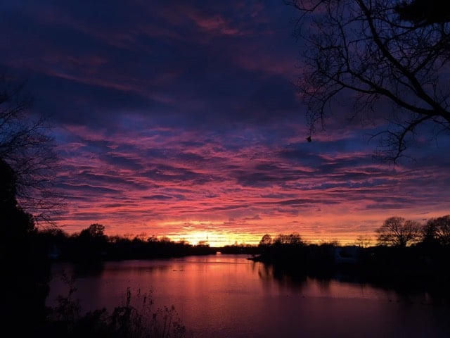
A team of three Pennsylvania meteorologists is now providing a coast-to-coast sunset quality forecast.
The team behind SunsetWx has already published a thorough methodology of its algorithm and a case study of successfully predicted “vivid” sunsets its first day of forecasting last week. Basically, the model blends high-resolution forecasts of humidity, pressure changes, and clouds at various levels of the atmosphere, weighting wispy upper-level clouds the strongest and penalizing for thick, low-level clouds or average clear sky evenings.
They totally called Sunday’s bonkers NYC sunset, so maybe they’re worth a follow. Sunset photo by @AirlineFlyer.
Slow motion video of a South Dakota lightning storm shot at 2000 fps.
I love the little tendrils “sent out” by the clouds before a big strike happens. It’s like nature is searching for the optimal path for the energy to travel and then BAM!
Storm-chasing photographer Kelly DeLay recently took a photo of a massive storm supercell featuring two simultaneous tornadoes.
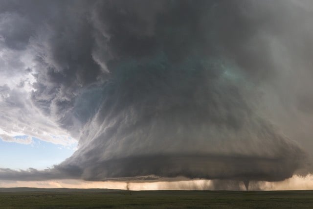
About 30 minutes after snapping that once-in-lifetime photo, DeLay captured a shot of the same supercell with one tornado, a double rainbow, and several streaking hailstones:
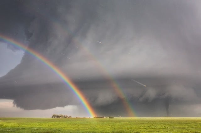
That’s like the everything bagel of storm photography. (via 500px iso)
This time lapse video of storm clouds by Nicolaus Wegner is flat-out incredible, by far the best of its kind.
Crank up the sound for this one. Previously: Stormscapes 1. (via bad astronomy)
This map showing where lighting strikes are happening right now is kind of great:
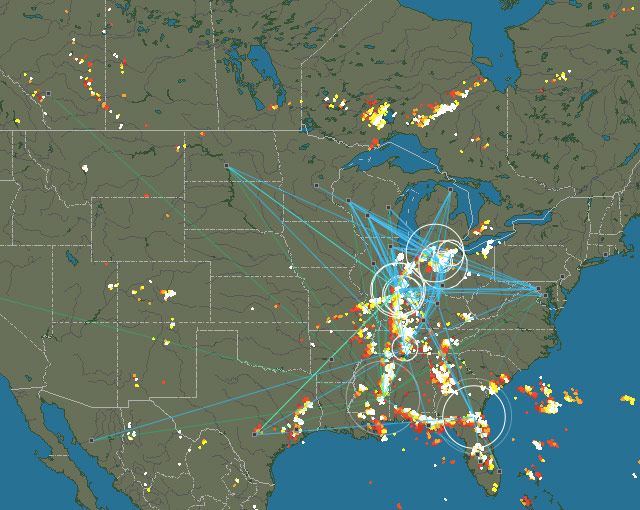
Average delay is about 3-5 seconds. Make sure you turn the sound up too. That’s the North American map…there are also maps for Europe, Asia, Australia, and South America, although only NA, Europe, and Australia seem to have detectors in place.
The detection system is volunteer community effort. Anyone who wants to can buy a detection kit (for around 200 Euro) and hook it up to the Internet to provide strike data. In turn, the data collected from stations is made available to any station owner. See also the wind map of the Earth and the realtime map of global ocean currents.
According to a new study, hurricanes with female names kill more people because Americans are less fearful of storms named after women:
The stereotypes that underlie these judgments are subtle and not necessarily hostile toward women — they may involve viewing women as warmer and less aggressive than men.
Then again, maybe this study blows… (If your first name is Hurricane, I don’t even care what your last name is.)
Other aspects of the team’s analysis didn’t make sense to Lazo. For example, they included indirect deaths in their fatality counts, which includes people who, say, are killed by fallen electrical lines in the clean-up after a storm. “How would gender name influence that sort of fatality?” he asks. He also notes that the damage a hurricane inflicts depends on things like how buildings are constructed, and other actions that we take long before a hurricane is named, or even before it forms.
From Stephen Locke, a time lapse video of thunderstorm supercells forming near Climax, Kansas.
Jiminy, that’s breathtaking. I didn’t know there was so much rotation involved in thunderstorms…the entire cloud structure is rotating. (via bad astronomy)
According to the National Climate Assessment, climate change has already affected the US in significant ways. This map from the NY Times shows the change in temperatures from around the country, specifically the “1991-2012 average temperature compared with 1901-1960 average”.
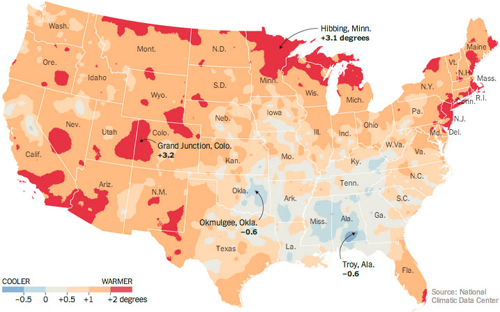
Among the report’s findings? As I’ve noted before, weather is getting weirder and more bursty, not just hotter.
One of the report’s most striking findings concerned the rising frequency of torrential rains. Scientists have expected this effect for decades because more water is evaporating from a warming ocean surface, and the warmer atmosphere is able to hold the excess vapor, which then falls as rain or snow. But even the leading experts have been surprised by the scope of the change.
The report found that the eastern half of the country is receiving more precipitation in general. And over the past half-century, the proportion of precipitation that is falling in very heavy rain events has jumped by 71 percent in the Northeast, by 37 percent in the Midwest and by 27 percent in the South, the report found.
Nonlinear systems, man.
This is fucking great and crazy…when the snow hit NYC yesterday, Casey Neistat grabbed his snowboard and went snowboarding behind a Jeep in the East Village.
Nicolaus Wegner shot some gorgeous footage of thunderstorms and cloud formations in South Dakota and Wyoming during the summer of 2013.
(via devour)
In a presentation for the Visualized conference, Jonathan Corum says that he looks for the “weight of rain” when working on data graphics.
So when I’m looking at data, or working on an explanatory graphic, these are the moments I’m looking for. Little “Aha!” moments that I can point to, and say “Look here, something happened,” and then try to explain. Often those small moments can help lead a reader into the graphic, or help to explain the whole.
The actual non-metaphorical weight of rain is surprisingly heavy; an inch of rain on an acre of land weighs 113.31 tons.
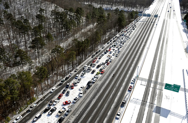
It sounds odd that a city would be digging out from a few inches of snow. But Atlanta residents were faced with a whole lot of chaos (and even more traffic) when they were hit with some unusually white weather.
We’re talking about kids spending the night their schools, commutes a few miles that took more than ten hours, helicopters searching for stranded drivers, and a call to the National Guard for help.
From InFocus, here’s a collection of photos that will give you a good idea of what happens when snowstorm hits a population not accustomed to that kind of weather.
Talking about the weather used to be a euphemism for talking about nothing. Now it can mean talking about everything.
Update: This is the best post I read about the snowfall in the South.
But if you’re making light of the situation, or more realistically using it to reinforce your view of the South and the people in it as full of backwards blubberers, you are an asshole. It’s hard to remember sometimes, but things are different in places you do not personally live.
When it snows where you live, the salt and the snowplows are out on the streets before you even wake up. When you talk about six inches of snow in your city, you are almost definitely talking about six inches of snow on the median strip and shoulder, and highways that are slick, but clear. I’d take that over two inches of snow and ice on every major road any day.
When it snows where you live, it is the latest in a string of snowfalls that date back centuries. You own a car with four-wheel-drive for that very purpose. You may even own snow tires. This is great! You are prepared. But waking up in Birmingham to snow is like waking up in New Hampshire to quicksand.
The internet’s resident meteorologist Eric Holthaus (who incidentally has given up flying because of climate change) warns that a major storm could be on its way to the East Coast in time for Thanksgiving and Hanukkah (which overlap this year and then not again until the year 79811).
Technically, the storm is a nor’easter but is looking more like a tropical storm in the computer models:
At this point, the most likely scenario would be cold, wind-driven rain in the big coastal US cities, with up to a foot of snow stretching from inland New England as far south as the Carolinas. The cold would stick around after the storm exits, with high temperatures in the 20s and wind chills possibly in the single digits as far south as New Jersey on Black Friday.
According to this afternoon’s iteration of the Euro model (a meteorological model that famously predicted superstorm Sandy’s rare left hook into New Jersey six days out), at the storm’s peak, wind gusts on Cape Cod could approach hurricane force.
We’re still a ways out, so things might change, but travel safely next week, folks. (via @marcprecipice)
From the team that brought you Dark Sky, an app that has saved (or at least kept dry) my bacon more times than I can count, comes Forecast, a weather web site that incorporates several of the features that made Dark Sky great. From the announcement:
Rather than cram these things into Dark Sky, we decided to do something grander: create our own full-featured weather service from scratch, complete with 7-day forecasts that cover the whole world, beautiful weather visualizations, and a time machine for exploring the weather in the past and far future. You can access it from all of your devices, whether it be your laptop, iPhone, Android phone, or tablet.
On top of all that, we’re providing this data to other developers, in the hopes that a truly independent weather community can thrive in the era of increasing corporate consolidation.
With the northeast still smarting from their two+ feet of snow, it’s worth watching this two minute video to see how those trillions of flakes were born.
For more, this recent 16 minute Radiolab segment looks into whether perfect snowflakes exist.
There’s a blizzard bearing down on the northeastern United States and here’s some essential information you need to know if you live in an affected area:
But seriously, you should follow @EricHolthaus for the latest storm info. (Ok, so we have our first celebrity Twitter weatherman. Weather and climate are going to become a lot more important in American pop culture…at what point do Gawker or Buzzfeed launch their climate verticals?)
Update: Gawker now has a climate vertical, The Vane. (via @bgporter)
As previously reported, global warming doesn’t just mean the Earth is getting warmer…the weather is getting weirder.
Britons may remember 2012 as the year the weather spun off its rails in a chaotic concoction of drought, deluge and flooding, but the unpredictability of it all turns out to have been all too predictable: Around the world, extreme has become the new commonplace.
Especially lately. China is enduring its coldest winter in nearly 30 years. Brazil is in the grip of a dreadful heat spell. Eastern Russia is so freezing — minus 50 degrees Fahrenheit, and counting — that the traffic lights recently stopped working in the city of Yakutsk.
Bush fires are raging across Australia, fueled by a record-shattering heat wave. Pakistan was inundated by unexpected flooding in September. A vicious storm bringing rain, snow and floods just struck the Middle East. And in the United States, scientists confirmed this week what people could have figured out simply by going outside: last year was the hottest since records began.
BTW, this story was published the day before the NY Times announced that they are dismantling their environment news desk and dispersing the nine-person staff throughout the newsroom.
It wasn’t a decision we made lightly,” said Dean Baquet, the paper’s managing editor for news operations. “To both me and Jill [Abramson, executive editor], coverage of the environment is what separates the New York Times from other papers. We devote a lot of resources to it, now more than ever. We have not lost any desire for environmental coverage. This is purely a structural matter.”
This seems like a step in the wrong direction. Which prominent national publication will be brave and start pushing climate change coverage alongside that of politics, business, and sports? At the very least, the Times should have a weekly Climate Change section, the New Yorker should have a yearly Climate issue, Buzzfeed should have a Climate & Weather vertical, etc. (via @tcarmody)
In 2006, New York magazine published a piece by Clive Thompson about what climate change is doing to New York’s weather.
Nobody really knows what’ll happen more than a week in advance, of course. But if we assemble these major climatic trends, a rough snapshot of New York’s future begins to emerge.
First off, El Nino will keep our winters reasonably mild and reduce hurricanes in the immediate future, possibly until as late as 2008, because El Ninos usually last for only one or two years.
Meanwhile, the AMO will remain in its warm phase, charging up storms and hurricanes off our shores, for much longer, probably another twenty years. So while El Nino may be driving a temporary reprieve in our nasty weather, once it dissipates, the long-term trend is back to tumultuous hurricane seasons.
The final ingredient in the mix is global warming. In the past century, the average temperature in New York has risen by two degrees, and the trend shows no sign of slowing down. Indeed, the computer models reviewed in the “Metropolitan East Coast Climate Assessment” — a 50-year prediction of New York’s changing climate, developed by nasa and Columbia University — suggest that the city will continue to heat up by as much as one degree by 2010, two degrees by 2020, and accelerate on a gentle curve until we reach as much as nine degrees warmer than now in 2100. It doesn’t particularly matter whether you believe the warming is man-made or a natural cycle (most, but not all, climatologists believe the former). The point is, pumping that much extra energy into the system is bound to have some effect.
The impact on our daily life, though, is the big question. A few degrees of warming won’t turn New York into a Miami-class shirtsleeves town. The effect will be more subtle: Climate scientists suspect that a warmer climate will produce more weather volatility. It’s not that we’ll have more rain overall, more snow overall, or more storms overall. But each event will be more intense than before.
“We’re more likely to get hotter heat waves,” says Mark Cane, a climatologist at Columbia University. “And increased storminess” adds Cullen. Both effects are due to the additional energy that global warming pumps into the “hydrological cycle,” the water and energy that circulates through the atmosphere — and it’s water that creates weather.
As they say, “nailed it”. The term “global warming” continues to be a misleading when it comes to the effect of the Earth’s increasing temperature on our weather; as Thompson notes, it’s not that it’s just gonna get a little hotter in the summer or a little less snowy in the winter, the weather’s gonna get weirder. Which is a problem…it’s difficult for society to measure and talk about “weird”.
Jason is still without power, but he and family are doing fine.
JFK and Newark are open, but jammed.
ConEd is saying Manhattanites without power will get it back within 3 days. Interactive map of the outages. Long Island could be longer. ConEd map here.
Some subway service should return Thursday, likely north of Midtown. Transit updates here.
With people returning to work, traffic is bad. As power returns, more people going back to work, could make the traffic worse.
NYTimes has a good summary of the storm damage along the East Coast.
AP photo of what’s left of Breezy Point after the fire Monday night.
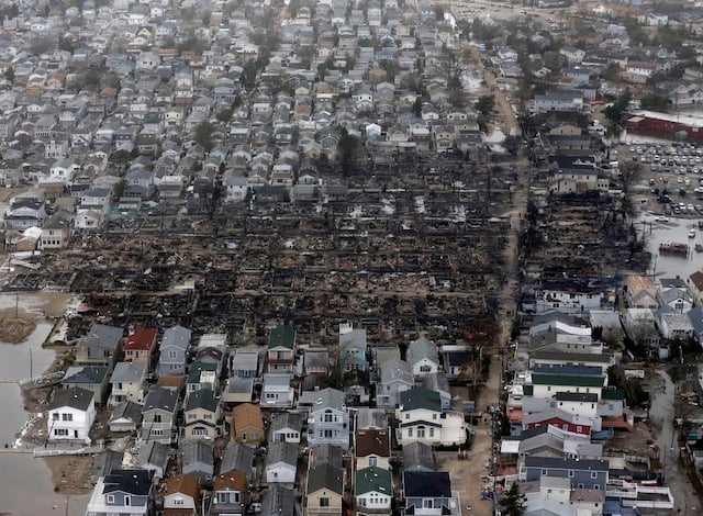
Collection of Sandy photos from the Boston Globe.
Video of storm from birth to landfall.
(Jason and family are fine, but without power, unsure of when it will come back. Aaron will be updating this throughout the day.)
Hurricane Sandy went through New York City yesterday causing massive flooding and power loss all over the city. While expectations for the storm had ranged across the spectrum, most observers seemed to be caught off guard at the amount of destruction. Here is the Kottke.org Hurricane Sandy link from yesterday and the one from the day before.
Updated Wed 12:15am ET:
22 deaths reported in New York City, 40 total in eight states combined. Several dozen more in Haiti and the Caribbean. This in the NYTimes, talks about two of NYC’s fatalities.
Sunday’s NYC Marathon will go on.
If you’re still without power, it could be 4-5 days before it comes back. And it’s not looking great for the subway, either.
Really old skeleton unearthed by fallen tree in New Haven.
David reminded us about how oysters might be able to help with future flooding (and did in the past).
I asked my friend Kevin for a few words on how a new New Yorker rode out the storm.
During the worst of the storm, around 9 p.m., I was huddled in my bed watching Homeland on my laptop, scanning Thought Catalog’s surprisingly good Hurricane Sandy Liveblog, and checking Twitter, which was probably in the finest form I’ve seen it in a long time: a terrific balance of helpful updates, links, GIFs, and personal communication. Even misinformation, which spreads like wildfire via retweet, was quickly debunked, like CNN’s report that the NYSE was under three feet of water. My one disappointment was Twitter’s fake satirical accounts, which were mostly uninspired, with the bold exceptions of @ElBloombito and @RomneyStormTips (which was mysteriously shut down).
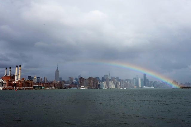
Finally, a rainbow by Noah Kalina.
Updated Tues 5:15pm ET:
This might be a dark cloud for many New Yorkers still digging out. Disney has purchased Lucasfilm and plans to release a new Star Wars feature film every 2-3 years. Star Wars 7 comes out in 2015. This information is being delivered to Jason by land line telephone, like in the old days.
A list of open New York City restaurants.
Sea level will be at Sandy levels normally by 2200.
Phenomenal illustration of the effect of last night’s power outage on the NYC skyline.
I’ve not been able to find much information about the impact the storm damage in NJ, NYC, CT, and DE will have on the election. Not on the politics of it, which have been interesting, but will people actually be able to vote? I just heard a radio report on All Things Considered that officials in NJ and CT, at least, are assessing the issue now and considering all options such as loosening absentee ballot rules, paper ballots, generators in voting locations, etc. While states have the responsibility of managing the elections, the date of the election is mandated by the Constitution as “the first Tuesday after the first Monday in November.” It’s unclear whether states have the power to move this date, but preventing citizens from having to vote after most of the votes in the country have been cast is the priority at this point.
A fantastic infographic of storm info/damage from NYTimes.
Updated Tues 2:00pm ET:
Up here in Boston, things seem to be OK. My neighborhood experienced high winds and whipping rain, but fairly low damage. My street, which floods once or twice a year in heavy rain, was fine. There are reports of branches and trees downing power lines around Cambridge, Somerville, Boston, etc, but most friends that lost power got it back after a relatively short period.
New York death toll updated to 15, 10 in the city.
Buses should be up and running by 5PM, on a Sunday schedule, and will be free today and tomorrow.
All of Jersey City and Newark are without power.
New York City specific ‘how to help’ link.
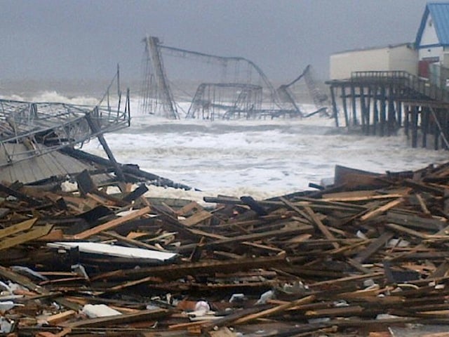
NBC’s Brian Thompson got a pic of the roller coaster at Seaside Heights in New Jersey in the ocean. (via theatlanticwire)
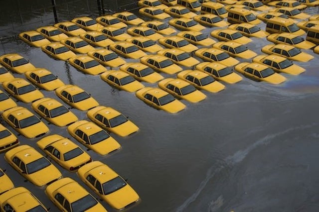
AP photo of cabs underwater in Hoboken. (via theatlanticwire)
Tappan Zee Bridge, East River Bridges, RFK Bridge, Lincoln Tunnel open.
JFK should open tomorrow. Laguardia has runways underwater and may take a little longer.
Matt Stopera is walking around providing pretty remarkable photos of other damage in his Twitter stream. Like this one, this one, and this one.
I can’t believe these ‘boats on shore pictures’. 1. 2.
Watch this transformer explode in Queens.
As of now, there are 9 reported storm-related fatalities in New York. Across the East Coast, the number is reported to be 14 total.
Mayor Bloomberg spoke earlier this morning to update the city. “This was a devastating storm. Maybe the worst that we have ever experienced.” (This video seems wonky, you might have to scroll forward to get it started.)
All of the MTA tunnels under the rivers flooded, and, “There is currently no timetable” for when the subway will be up and running again.
As of last night, seven subway tunnels under the East River flooded. Metro-North Railroad lost power from 59th Street to Croton-Harmon on the Hudson Line and to New Haven on the New Haven Line. The Long Island Rail Road evacuated its West Side Yards and suffered flooding in one East River tunnel. The Hugh L. Carey Tunnel is flooded from end to end and the Queens Midtown Tunnel also took on water and was closed. Six bus garages were disabled by high water. We are assessing the extent of the damage and beginning the process of recovery. Our employees have shown remarkable dedication over the past few days, and I thank them on behalf of every New Yorker. In 108 years, our employees have never faced a challenge like the one that confronts us now. All of us at the MTA are committed to restoring the system as quickly as we can to help bring New York back to normal.
MTA’s photo stream shows damage in the stations.
The back up generator at NYU Hospital failed last night forcing hospital staff, firefighters, and EMTs to carry patients down flights of stairs as they were evacuated to other hospitals.
There was an enormous 6 alarm fire in the Breezy Point area of Queens, destroying at least 50 homes. 200 firefighters fought chest-high water to battle the fire and rescue residents. An image of the destruction.
Along with hundreds of thousands of New Yorkers, Gizmodo, Gawker, Daily Kos, and Buzzfeed were among many websites which went down after their data-centers in lower Manhattan lost power.
Letterman and Fallon did their shows without audiences last night.
Crazy video of a ConEd plant exploding on E14 and FDR.
Video of flooding at East 8th and Avenue C, especially spooky because the power suddenly goes out at the :40 second mark. (via Gawker)
Almost 6,000 flights were canceled today.
It’s about 1:30 pm here in NYC and we’re starting to see the effects of Hurricane Sandy. Rivers are overflowing their banks, wind is whipping, and residents are either hunkered down or scurrying around picking up last minute supplies. I’ll be updating this post when I can, here and there, during the course of the day.
Updated Mon 7:42pm ET:
Kids are way worse than the hurricane today. FEMA, NYPD, FDNY, need emergency parental evac now!
What to Expect at Landfall in Next Two Hours (WSJ):
The storm’s quicker-than-expected forward motion means it will make landfall about two hours sooner than previously anticipated. Landfall is now expected around 6 p.m. this evening, near or just south of Atlantic City, N.J. This doesn’t change the forecast much for coastal New Jersey, but it could greatly complicate coastal flooding projections for New York Harbor.
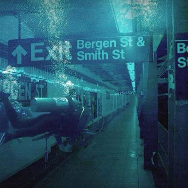
Whoa, it looks like the situation in the Brooklyn subway is getting dire:
Twitter has compiled a list of hurricane resources on Twitter.
Here’s a close-up photo of that crane that’s dangling from that building on 57th Street. CBS has a live view of the crane.
Not from The Onion, but this report on how Williamsburg residents are coping with the storm sure reads like it:
“I just got these kick-ass new stereo speakers and I am going to listen to those until the power runs out,” Jim Butler, another Edge resident, said, tugging on the doors of the CVS that is part of the complex-it had just closed a few minutes before 5 p.m. “Then I’m going to read and look at my art books. I’ll live by candlelight, get in touch with my 19th century self.”
From just now on the TV: Con Ed has taken down the Bowling Green and Fulton electrical networks in lower Manhattan. Likely area hit is “east of Broadway btwn Wall St & tip of Manhattan & from Frankfort to Wall btwn William St & East river.”
Water level at the Battery has hit 11.25 ft, breaking a record set in 1821.
Updated Mon 4:08pm ET:
Tweet from Jen Bekman:
[Con Ed] rep on NY1 sayspower shutdown “very likely” south of 34th st. 7-9pm for high tide.
Some common sense tips: how to make your cell phone charge last if the power goes out.
Walked by Joseph Leonard on Waverly Place here in the West Village earlier and it was jam packed.
Want to look at a bunch of good photos of the hurricane? Alan Taylor at In Focus has you covered.
Great story of how Dan Rather hacked up the first radar image of a hurricane shown on TV for Hurricane Carla in 1961.
He took a camera crew to the U.S. Weather Bureau (now the National Weather Service) office in downtown Galveston, which featured a cutting-edge WSR-57 radar console. He convinced the bureau staff to let him broadcast, live, from the office. He asked a Weather Bureau meteorologist to draw him a rough outline of the Gulf of Mexico on a transparent sheet of plastic; during the broadcast, he held that drawing over the computer’s black-and-white radar display to give his audience a sense both of Carla’s size and of the location of the storm’s eye. As CBS plugged into the broadcast, that audience suddenly became a national one.
Tappan Zee Bridge closed as of 4pm. And all bridges/tunnels in and out of Manhattan are closing at 7pm…or so I’ve heard on TV/Twitter. Is that right? Has anyone seen the Batman?
Things aren’t looking good on Nantucket. And probably not even close to max storm surge.
Updated Mon 3:47pm ET:
There are reports of a crane collapse at One World Trade but Jake Dobkin doesn’t see any evidence of that. (Update: Jake was right…no crane issue at 1WTC.)
Updated Mon 3:11pm ET:
More footage of the 1938 hurricane that hit the northeastern US.
Updated Mon 3:07pm ET:
Is TV news and Twitter whipping everyone into a hurricane-like froth with its incessant coverage of Sandy? Well, E.B. White has similar complaints about radio and Hurricane Edna back in 1954.
The radio either lets Nature alone or gives her the full treatment, as it did at the approach of the hurricane called Edna. The idea, of course, is that the radio shall perform a public service by warning people of a storm that might prove fatal; and this the radio certainly does. But another effect of the radio is to work people up to an incredible state of alarm many hours in advance of the blow, while they are still fanned by the mildest zephyrs.
That awesome photo you saw of Hurricane Sandy? It might not be Hurricane Sandy.
Vintage newsreel footage of hurricanes in 1938, 1955, and 1969.
Piers Morgan spotted a crane that has buckled on a building near CNN HQ in NYC (157 West 57th):
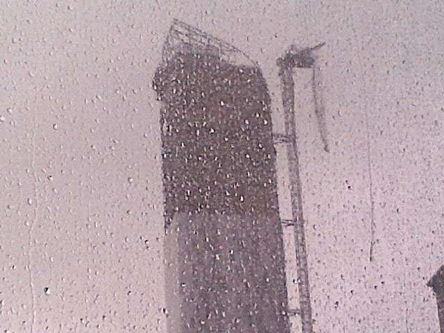
Massive bang and this giant skyscraper crane outside my office just buckled… Scary.
Updated Mon 2:19pm ET:
Lots of people have noted this feed of hurricane-related photos on Instagram.
NYC mayor Michael Bloomberg urges residents to “Have a sandwich out of the fridge. Sit back, and watch the television.” I am so there, Mr. Mayor.
The lower level of FDR Drive on the east side of Manhattan is underwater:
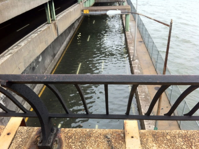
The storm surge in New York Harbor is getting serious.
Con Ed just called us saying that they might have to shut off our power. No timeline mentioned.
Climate change has not been an issue at all in the 2012 Presidential election. Elizabeth Kolbert says that’s “grotesque”.
BTW, Mitt Romney wants to shut down FEMA and have the states fend for themselves. United(?) States of America?
Earlier:
This WSJ comparison of 2011’s Hurricane Irene and Sandy really captures just how massive this storm is and why people seem more concerned about it than they were with Irene.
Via Jeff Masters, Sandy is already producing record storm surges:
The National Weather Service in Atlantic City, NJ said that isolated record storm surge flooding already occurred along portions of the New Jersey coast with this morning’s 7:30 am EDT high tide cycle. As the tide goes out late this morning and this afternoon, water levels will fall, since the difference in water levels between low tide and high tide is about 5’. However, this evening, as the core of Sandy moves ashore, the storm will carry with it a gigantic bulge of water that will raise waters levels to the highest storm tides ever seen in over a century of record keeping, along much of the coastline of New Jersey and New York. The peak danger will be between 7 pm - 10 pm, when storm surge rides in on top of the high tide. The full moon is today, which means astronomical high tide will be about 5% higher than the average high tide for the month, adding another 2 - 3” to water levels.
The Holland Tunnel and the Brooklyn Battery Tunnel will be closing at 2pm today.
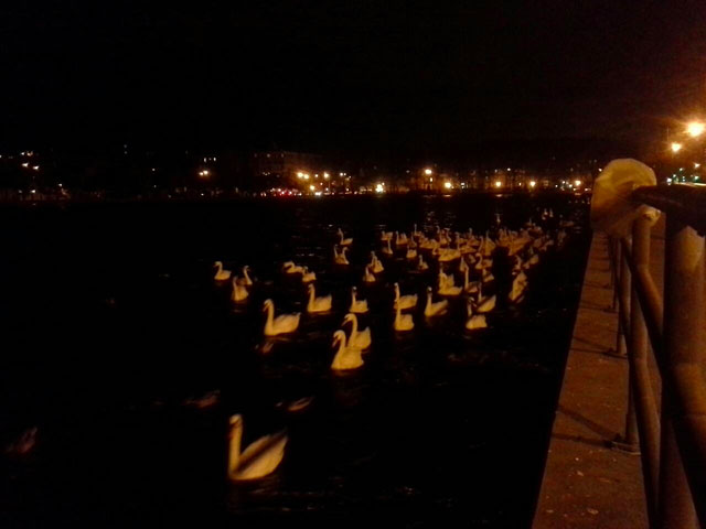
The swans are leaving Sheepshead Bay in Brooklyn:
Here’s a satellite view of Sandy developing near the equator and building in strength as it churns through the Caribbean and up the Atlantic coast:
Here’s my post from yesterday with all sorts of hurricane resources, including Jeff Master’s WunderBlog, the Wind Map, and check out your flood zone in NYC.
I don’t know how much I’m going to be updating this, but here’s a few things about the hurricane that’s bearing down on the East Coast right now. Mostly NYC centric.
Updated Sun 11:52pm ET:
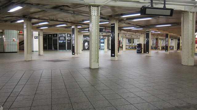
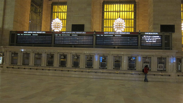
The main hall of the closed Grand Central Terminal, deserted. Even stranger, the busiest subway station in NYC (Times Square), closed and deserted.
The Wind Map will likely be interesting over the next 36-48 hours. (via @panicstreak)
From Jeff Masters’ WunderBlog, a more technical view of the storm:
The National Weather Service in Upton, New York mentioned today that the predicted maximum water level of 11.7 feet at The Battery in New York City, which is expected to occur at 8:13pm ET on Monday, would break the record of 10.5 feet which was set on September 15, 1960 in Hurricane Donna.
The storm’s barometric pressure is going to be historically low:
Sandy should have sustained winds at hurricane force, 75 - 80 mph, at landfall. Sandy’s central pressure is expected to drop from its current 953 mb to 945 - 950 mb at landfall Monday night. A pressure this low is extremely rare; according to wunderground weather historian Christopher C. Burt, the lowest pressure ever measured anywhere in the U.S. north of Cape Hatteras, NC, is 946 mb (27.94”) measured at the Bellport Coast Guard Station on Long Island, NY on September 21, 1938 during the great “Long Island Express” hurricane.
Masters says that part of the NYC subway system may flood:
The full moon is on Monday, which means astronomical high tide will be about 5% higher than the average high tide for the month. This will add another 2 - 3” to water levels. Fortunately, Sandy is now predicted to make a fairly rapid approach to the coast, meaning that the peak storm surge will not affect the coast for multiple high tide cycles. Sandy’s storm surge will be capable of overtopping the flood walls in Manhattan, which are only five feet above mean sea level. On August 28, 2011, Tropical Storm Irene brought a storm surge of 4.13’ and a storm tide of 9.5’ above MLLW to Battery Park on the south side of Manhattan. The waters poured over the flood walls into Lower Manhattan, but came 8 - 12” shy of being able to flood the New York City subway system. According to the latest storm surge forecast for NYC from NHC, Sandy’s storm surge is expected to be at least a foot higher than Irene’s. If the peak surge arrives near Monday evening’s high tide at 9 pm EDT, a portion of New York City’s subway system could flood, resulting in billions of dollars in damage. I give a 50% chance that Sandy’s storm surge will end up flooding a portion of the New York City subway system.
But Linsey Lohan urges you not to panic:
WHY is everyone in SUCH a panic about hurricane (i’m calling it Sally)..? Stop projecting negativity! Think positive and pray for peace.
US financial markets were supposed to be open tomorrow but officials now have closed the markets on Monday.
Updated Sun 8:54pm ET:
The Day After Tomorrow, a movie directed by Roland Emmerich in which a super storm hits Manhattan, is available for streaming ($2.99) or to buy ($9.99) on Amazon Instant Video and on iTunes for sale ($12.99).
John Seabrook notes on Twitter:
Full moon at 7.50pm tomorrow, ten minutes before the high point of storm surge. Seems kind of biblical…
Or Mayan. 2012, y’all.
Justin reminds me of a classic New Yorker piece by Joe Morgenstern about a NYC skyscraper that was unprepared for hurricane-force winds.
On a warm June day in 1978, William J. LeMessurier, one of the nation’s leading structural engineers, received a phone call at his headquarters, in Cambridge, Massachusetts, from an engineering student in New Jersey. The young man, whose name has been lost in the swirl of subsequent events, said that his professor had assigned him to write a paper on the Citicorp tower, the slash-topped silver skyscraper that had become, on its completion in Manhattan the year before, the seventh-tallest building in the world.
LeMessurier found the subject hard to resist, even though the call caught him in the middle of a meeting. As a structural consultant to the architect Hugh Stubbins, Jr., he had designed the twenty-five-thousand-ton steel skeleton beneath the tower’s sleek aluminum skin. And, in a field where architects usually get all the credit, the engineer, then fifty-two, had won his own share of praise for the tower’s technical elegance and singular grace; indeed, earlier that year he had been elected to the National Academy of Engineering, the highest honor his profession bestows. Excusing himself from the meeting, LeMessurier asked his caller how he could help.
The student wondered about the columns—there are four—that held the building up. According to his professor, LeMessurier had put them in the wrong place.
“I was very nice to this young man,” LeMessurier recalls. “But I said, ‘Listen, I want you to tell your teacher that he doesn’t know what the hell he’s talking about, because he doesn’t know the problem that had to be solved.’ I promised to call back after my meeting and explain the whole thing.”
Updated Sun 8:22pm ET:
From the excellent coverage at WSJ:
Those living above the 10th floor in skyscrapers may want to find shelter in lower floors. Winds increase with height in a hurricane and could be significantly stronger than on ground level. Be cautious about sleeping near a window on Monday night. Do not walk outside on Monday evening, as there could be significant amounts of airborne debris flying around. Rain totals 4-8 inches.
Not a sight you see that often: Grand Central is closed.
From Quartz, a list of webcams to watch as Sandy approaches.
Updated Sun 8:11pm ET:
BREAKING NEWS! [siren] Powerful Storm Brings Down NY Times Paywall: “The Times is providing free unlimited access to storm coverage on nytimes.com and its mobile apps.”
From When There’s a Flood: if you’re preparing your house for a flood, shut off the water, propane, and electricity.
Just checked Uber in the West Village…about 10 cars less than three minutes away. Usually a lot less inventory than that.
Was rumored that MoMA would be open tomorrow with skeleton crew but word just now from their Twitter account: closed tomorrow.
From the NY Times:
If the surge runs as high as forecast, Con Ed will shut off two electrical networks in Lower Manhattan, known as the Fulton and Beekman networks, the official said.
I looked all over the place for a map that showed which parts of the city are served by the Fulton and Beekman but couldn’t find anything. I’m assuming the Fulton station is near the World Trade Center and the Beekman is on Beekman St by Pace University. So way Lower Manhattan?
Earlier:
Subway, bus and railroad services in New York and New Jersey are being shut down starting at 7pm tonight. Probably won’t be back open until sometime on Wednesday.
NYC schools are closed on Monday. And probably Tuesday. And if public transit is closed on Wed, schools with probably be closed that day too.
Taping your windows to protect them from hurricanes is “a waste of effort, time, and tape”.
Residents in Zone A in NYC have been ordered to evacuate. Check out where your zone is here.
New York City’s Hurricane brochure is available here.
The tracking map on Weather Underground gives you the opportunity to “share this storm”. Weather.com lets you see “friends at risk.” Uhh….
For storm updates in Spanish, be sure to follow Miguel Bloombito:
Did tu packo el vamos bag? No forgeto el casho, los medicatioño y tamponitos.
The WSJ has a great post comparing Sandy with Irene from last year. Sandy is much more potentially damaging in almost all respects.
On Saturday, Sandy became the largest storm in recorded Atlantic basin history, with a diameter of gale force winds of over 1000 miles. Tropical storm warnings were in place Saturday simultaneously for North Carolina and Bermuda, a sign of the storm’s massive geographic sweep. Those winds will follow Sandy northward, potentially encompassing more than 50 million people at once from Virginia to New England.
Peter Kafka paraphrasing Bloomberg: “don’t be stupid and it will be fine”.
Satellite view of Sandy from 2:42 am last night. Massive. This thing is Day After Tomorrow big.
Zones, evacuation centers, webcams, and more on this Google Maps maps.
Chad Dickerson notes that the decentralization of NYC’s stores is a plus:
the institution of the neighborhood corner store in NYC comes through for storm prep. decentralization ftw!
XKCD’s What If? science feature continues to delight. This week’s question is “What if a rainstorm dropped all of its water in a single giant drop?”
The drop is now falling at 90 meters per second (200 mph). The roaring wind whips up the surface of the water into spray. The leading edge of the droplet turns to foam as air is forced into the liquid. If it kept falling for long enough, these forces would gradually disperse the entire droplet into rain.
Before that can happen, about 20 seconds after formation, the edge of the droplet hits the ground. The water is now moving at over 200 m/s (450 mph). Right under the point of impact, the air is unable to rush out of the way fast enough, and the compression heats it so quickly that the grass would catch fire if it had time.
Fortunately for the grass, this heat lasts only a few milliseconds because it’s doused by the arrival of a lot of cold water. Unfortunately for the grass, the cold water is moving at over half the speed of sound.
Yesterday In Focus featured new work from photographer Camille Seaman: storm clouds in the skies of the Midwest.
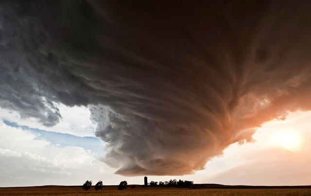
Nice cumulonimbus mammatus in #s 4, 14, and 16. And by coincidence, the NY Times Lens blog also featured Seaman’s work yesterday, an earlier project that entailed shooting portraits of icebergs.
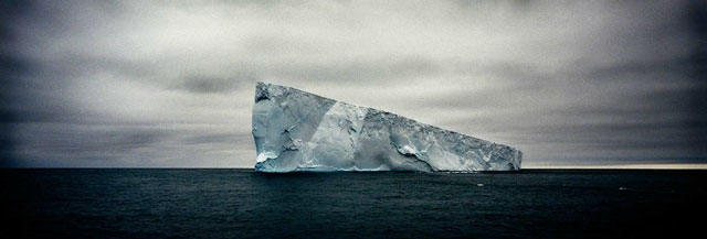
I like Seaman’s portraiture approach to things like clouds and icebergs:
“They are like humans in that each one reacts to its environment and its circumstances in its own way,” Camille Seaman, 42, said. “I’ve come across icebergs that were very stalwart and just refused to dissolve or break up. And there were others — massive, massive icebergs — that were like ‘I can’t take it anymore’ and in front of my eyes would just dissolve into the sea. There’s so many unique personalities. There’s a sadness to them.”
If I could package a cool breeze into a newsletter, I’d do it. Because a lot of you are hot. How hot? In towns across the U.S., 942 temperature records have already been broken this month. In June, 3,282 temperature records were broken. And since the beginning of the year, 23,283 daily high records have been set. These two maps tell the pretty amazing story of the 2012, the year of the heat.
Predicting the weather is really hard…butterfly wings flapping and all that. But often we only care about the very short term weather: Do I need to take an umbrella to the store? When’s this rain gonna stop? Is it going to start snowing before I get home? Enter Dark Sky, an iOS app currently in development.
Dark Sky is an app for the iPhone, iPad, and iPod touch that predicts the weather.
Using your precise location, it tells you when it will precipitate and for how long. For example: It might tell you that it will start raining in 8 minutes, with the rain lasting for 15 minutes followed by a 25 minute break.
How is it possible predict the weather down to the minute? What’s the catch?
Well, the catch is that it only works over a short period of time: a half hour to an hour in the future. But, as it turns out, this timespan is crucially important. Our lives are filled with short-term outdoor activities: Travelling to and from work, walking the dog, lunch with friends, outdoor sports, etc.
With a computer, some software, and a couple hundred dollars of hardware, you can pull down your own satellite images from satellites managed by the National Oceanic and Atmospheric Administration.
The National Oceanic and Atmospheric Administration (NOAA) manages a few satellites in low earth orbit. There are three actively transmitting APT signals at the moment, NOAA15, 17, and 18. Each of these satellites passes overhead a few times a day. I’ve been interested in learning how to receive their signals for a while now, and I’ve finally succeeded!
Newer posts
Older posts




Socials & More