When I linked to a recent NY Times article about rewilding golf courses, I pulled out this startling fact: “The United States has more golf courses than McDonald’s locations.” Nathan Yau of FlowingData found that that is indeed true but wondered where all of the golf courses were actually located. (A: typically not in cities where the McDonald’s are concentrated).
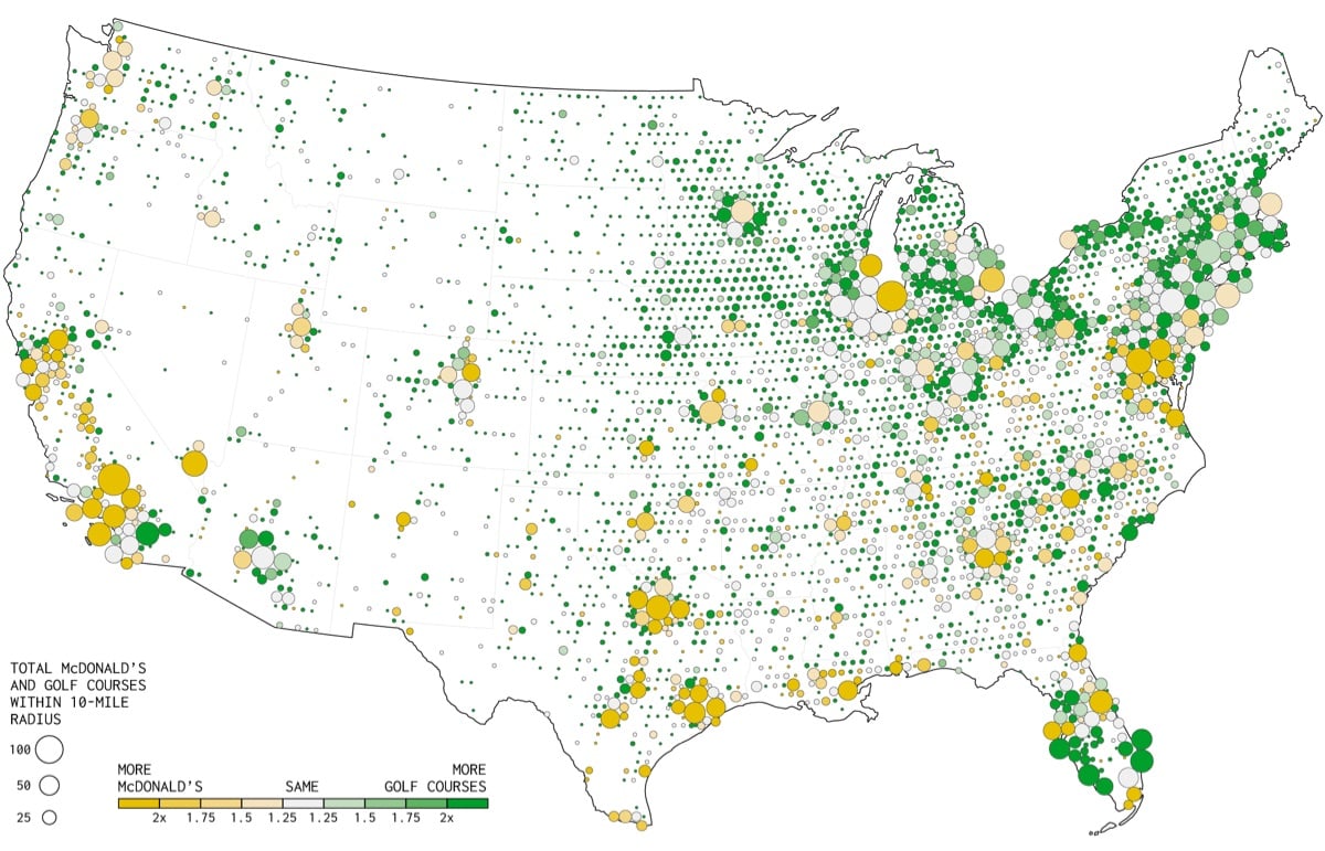
This makes more sense now. You can have a golf course in an area where there aren’t that many people, because people will travel to play golf. Few people are going to travel specifically for McDonald’s.
If we compare the two, you see the McDonald’s city concentrations, and golf fills the in-between spaces.
Nathan Yau of Flowing Data picked his ten favorite data visualization projects for 2019. All the projects listed are worth a look … but maybe, just maybe, this post is really just an excuse to let my eyes feast upon Scott Reinhard’s historic topographic maps once again.
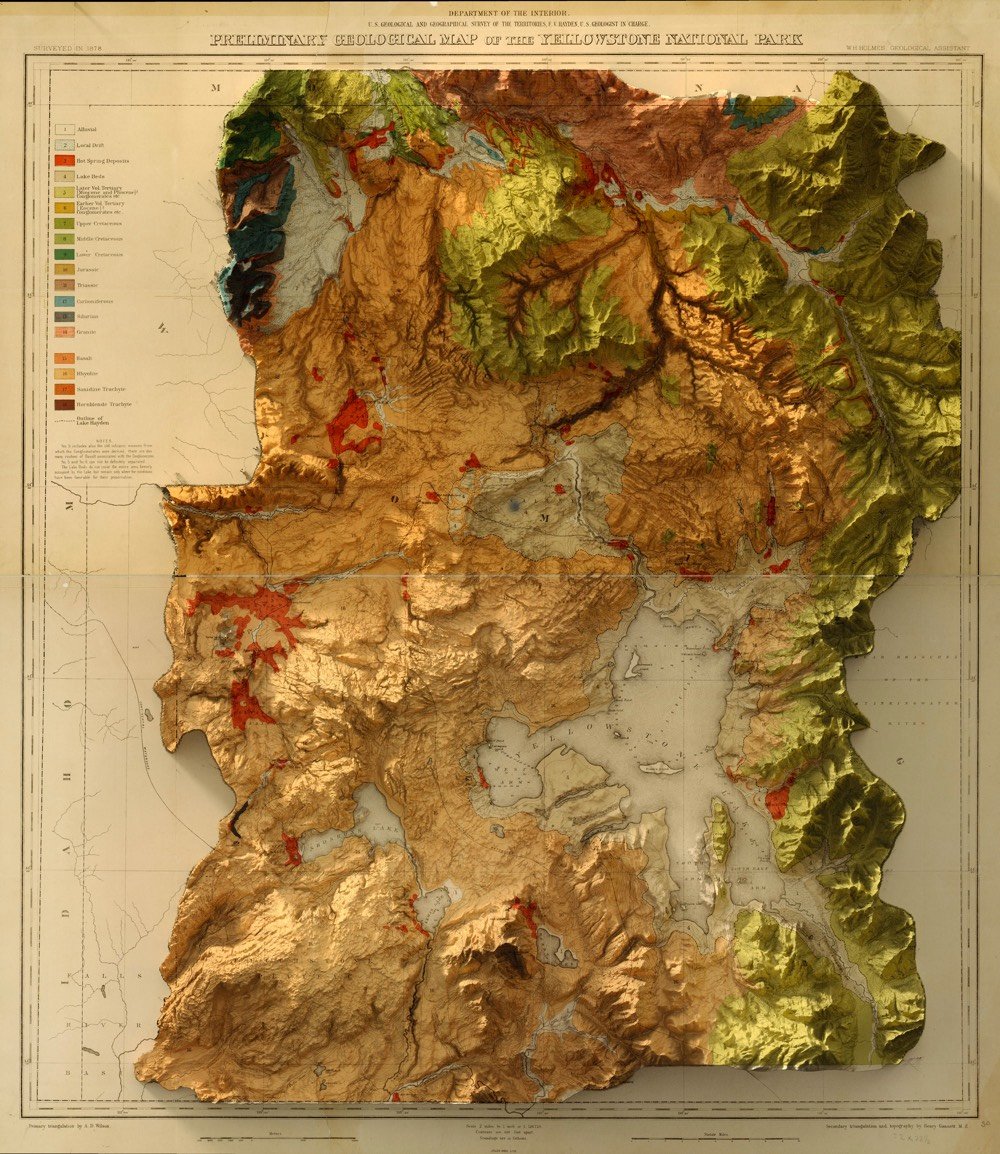
Designer Scott Reinhard takes old geological survey maps and combines them with elevation data to produce these wonderful hybrid topographic maps. From top to bottom, here are Reinhard’s 3D versions of a 1878 USGS Yellowstone map, a 1904 USGS map of Acadia National Park, and a 1899 USGS map of the Grand Tetons.
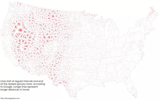
From Nathan Yau at FlowingData, a look at the places in the US where people need to make the longest drives to visit a grocery store.
The nearest grocery store is more than 10 miles away in about 36 percent of the country and the median distance is 7 miles. However, a lot of these areas are rural with few (if any) people who live there.
Wyoming contains very few grocery stores:
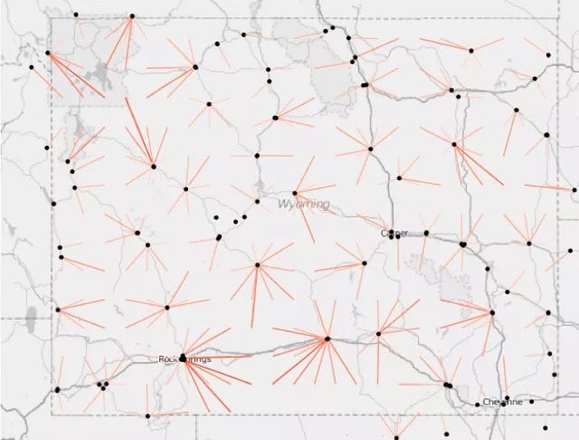
And Nevada is even more of a food desert. Looks like Massachusetts, Delaware, and New Jersey have plenty of grocery stores everywhere. (via feltron)




Stay Connected