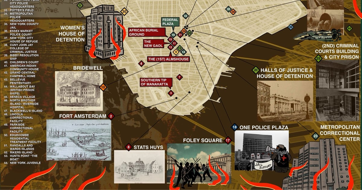
The Abolitionist Map of NYC
The website for the Abolitionist Guide to NYC is just getting started, but the site does house an Abolitionist Map of NYC.
The Abolitionist Map of NYC offers a geographic survey of incarceration and anti-carceral resistance in Manahatta from the Dutch colonization of Lenapehoking to the present day. The map highlights some of the first jails and prisons to exist in the area, the movement of facilities from one place to the next, and sites of rebellion against the expansion of the prison industrial complex.
It is meant to serve as a tool for abolitionist resistance grounded in a long view of the struggle, tactics, and goals.
The map is available as a PDF and as an interactive version. (via @prisonculture.bsky.social)
Comments 0
If you feel like this comment goes against the grain of the community guidelines or is otherwise inappropriate, please let me know and I will take a look at it.
In order to comment or fave, you need to be a kottke.org member. Check out your membership options.
Note: If you are a member and tried to log in, it didn't work, and now you're stuck in a neverending login loop of death, try disabling any ad blockers or extensions. Or try logging out and then back in. Still having trouble? Email me!