

Stunning Image of Our Satellite-Choked Night Skies
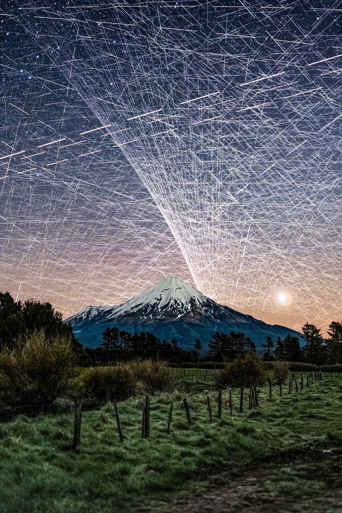
To create this composite image, photographer Brendan Larsen captured almost 600 photographs over a two-hour period and then manually stitched them together.
This is the most time-consuming photo edit I’ve EVER done!
I left my camera photographing the night sky over Mt Taranaki for nearly TWO HOURS, capturing 578 photographs.
The result? An estimated 14,450 satellite trail appearances, representing approximately 1,400 individual satellites! 😱
I manually masked in EVERY SINGLE TRAIL from the original photographs — approximately 45 HOURS of editing to create this one image!
The Guardian has more on how he created the image (which, despite many online commenters’ beliefs, is not AI):
Larsen, 51, says he set his camera up to take an unlimited number of eight-second-long shots, with a two-second gap in between each photo. “I left her running for two hours and captured 578 photos … That was the easy part.”
The hard part came next. Larsen spent about 45 hours layering the individual photos – each of which contained about 25 satellites – over one another, using Adobe Photoshop. Much of the time was spent painstakingly erasing stars, to reveal the satellites.
“I could start to see the pattern emerging and realised: ‘Wow, this looks really awesome.’ I knew if I carried on it would look even better and more impressive in terms of satellite numbers.”
Fellow photographer Vincent Laforet called Larsen’s image “an important photograph”:
I was initially startled. Then confused. Then fascinated all in quick succession.
And then I felt a deep sense of betrayal once I realized that what I was tracking with my eyes were a series of small satellites. And btw: that they likely had ruined my long exposure that I was capturing at the time.
I remember asking in the moment:
Who gave anyone permission do this?
Socials & More