Colorful New Geological Map of the Moon


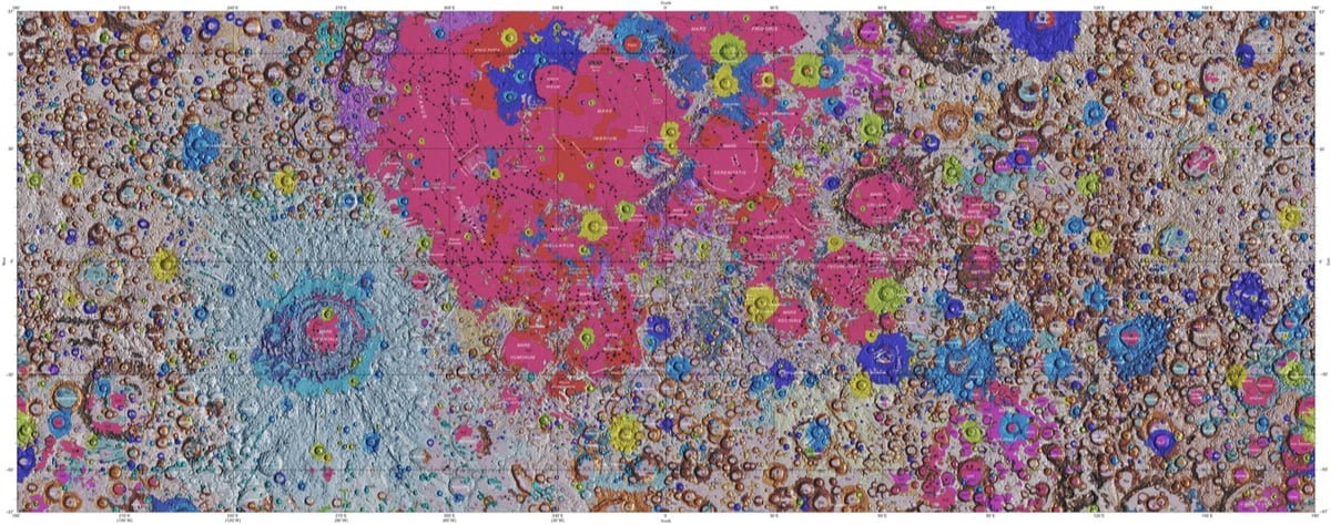
In collaboration with NASA and the Lunar and Planetary Institute, the USGS has released the first complete geological map of the Moon’s surface.
This new work represents a seamless, globally consistent, 1:5,000,000-scale geologic map derived from the six digitally renovated geologic maps (see Source Online Linkage below). The goal of this project was to create a digital resource for science research and analysis, future geologic mapping efforts, be it local-, regional-, or global-scale products, and as a resource for the educators and the public interested in lunar geology.
Strange Maps has more information on how the map came to be and what it shows.
The map was created by the U.S. Geological Service’s Astrogeology Science Center in Flagstaff, Arizona. In collaboration with NASA and the Lunar and Planetary Institute, it combined six ‘regional’ maps of the Moon made during the Apollo era (1961-1975) with input from more recent unmanned lunar missions.
This included data on the polar regions from NASA’s Lunar Orbiter Laser Altimeter (LOLA) and close-ups of the equatorial zone from the Japanese Space Agency’s recent SELENE mission.
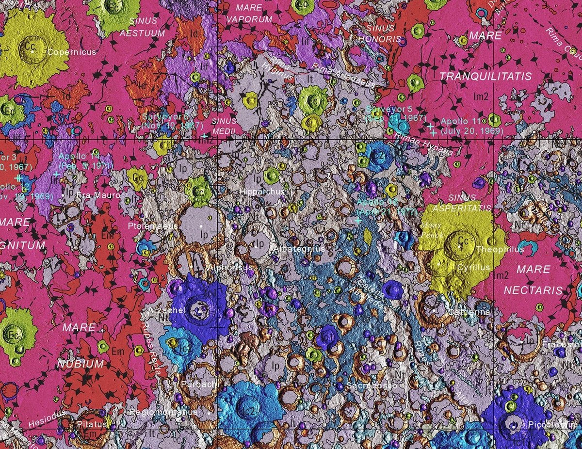
The two images above show the entire map and a detailed view of a single area (which includes the landing sites of 3 Apollo missions) while the video shows a rotating globe version of the map.


Stay Connected