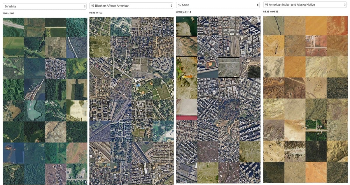
“What do census tracts with highest concentrations of particular populations look like?”
The use of satellite imagery has revolutionized many areas of science and research, from archaeology to tracking human rights abuses to (of course) climate science. This vantage point makes different sorts of observations possible than looking at ground level does.
In what she calls “a work in progress”, Jia Zhang, a PhD candidate at MIT Media Lab, used census data to collect chunks of satellite images from areas with the highest concentrations of white, black, Asian, and Native American & Alaska Native people. The result is striking (but perhaps not surprising):
I’m looking forward to seeing more of Zhang’s work in this area.
Socials & More