US road grid corrections because of the Earth’s curvature
Have you ever wondered why, when you’re driving along on a straight road in the Western US, there’s a weird curve or short zigzag turn thrown into the mix? Grids have been used to lay out American roads and houses since before there was a United States. One of the most prominent uses of the grid was in the Western US: the so-called Jefferson Grid.
The Land Ordinance of 1785, drafted by Thomas Jefferson, extended government authority over the Mississippi River and the Great Lakes regions. As a response to what he believed to be a confusing survey system already in use, Jefferson suggested a new grid system based on the rectangle. The grid divided land into plots one mile square, each consisting of 640 acres. The grid also placed a visible design upon a relatively untouched landscape.
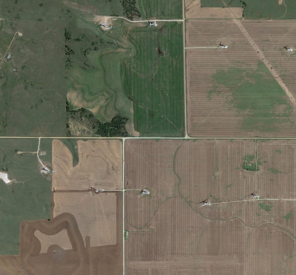
As most people know, the Earth is roughly spherical. When you try to cover the surface of a sphere with squares, they are not going to line up perfectly. That means, every so often, sections of the grid shift away from each other. Gerco de Ruijter’s short film, Grid Corrections, shows dozens of examples of places where this shift occurs and the corrections employed to correct them.
By superimposing a rectangular grid on the earth surface, a grid built from exact square miles, the spherical deviations have to be fixed. After all, the grid has only two dimensions. The north-south boundaries in the grid are on the lines of longitude, which converge to the north. The roads that follow these boundaries must dogleg every twenty-four miles to counter the diminishing distances.
If you want to look at some of the corrections yourself, try this location in Kansas (or this one). See that bend? Now scroll the map left and right and you’ll see a bunch of the north/south roads bending at that same latitude.
You can read more about de Ruijter’s project and grid corrections in this Travel & Leisure article by Geoff Manaugh.
Update: An email from my dad:
Hi son, just reading your blog on the section lines….don’t forget, you used to live on a correction line…that is why 3 of my 40’s were only 26.3 acres….
“40’s” refers to 40 acre plots…a common size for a parcel of land back when that area was divvied up. Wisconsin has so many lakes, rivers, and glacial features that interrupt the grid that it’s difficult to tell where the corrections are, but looking at the map, I can see a few roads curving at that latitude. Cool!
Socials & More