Detailed Martian Geologic Maps from the USGS
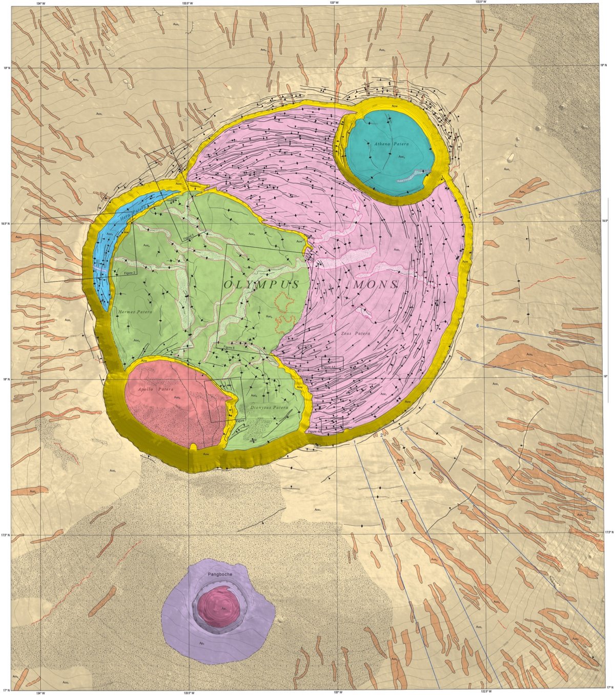
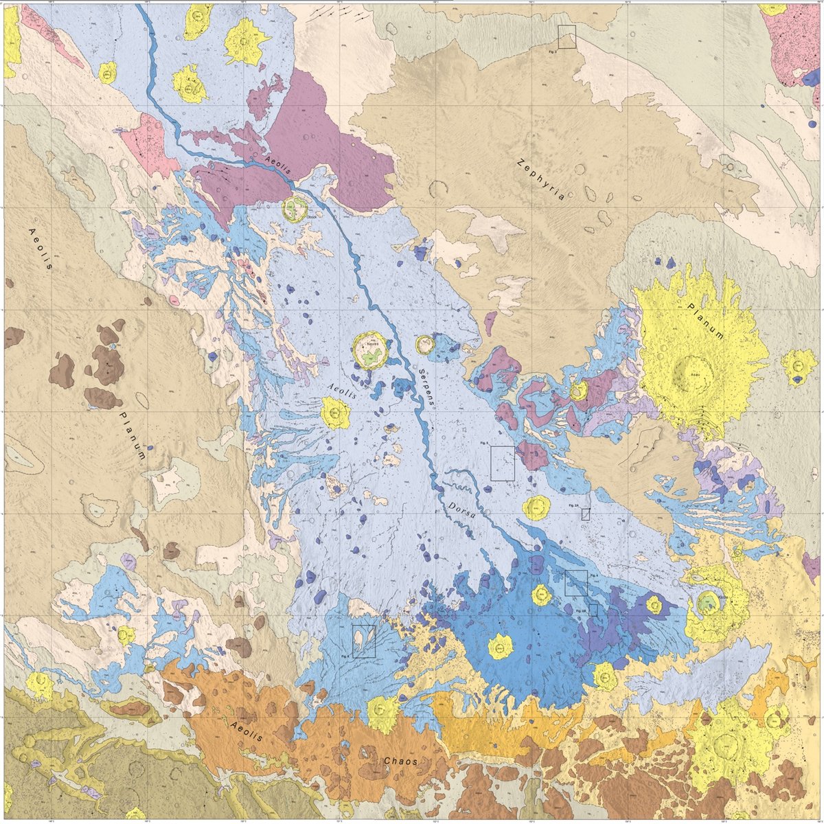
The USGS Astrogeology Science Center recently released a series of detailed geological maps of Mars that detail features from the red planet’s past like volcanos and flowing water. If you’re thinking, “hey that looks a lot like a river in that second image”, you’re not far off.
One particularly interesting feature that hints at Mars’ watery past is the sinuous ridge, which is a winding, narrow ridge that looks like an inverted river channel. These ridges are interpreted to be aqueous (formed by water), making them possible clues about the history of water on Mars.
The scale of the maps is useful for identifying geologic changes over time:
The new map of Aeolis Dorsa adds to the hypothesis that Mars was once wet and had abundant active river systems in the past before aqueous activity decreased over time. This change caused the primary depositional methods in the region to shift from rivers (fluvial) to sediment fans with intermittent deposition (alluvial) and eventually to a dry and wind-driven (aeolian) system. This local pattern mimics our current understanding of the global environmental history of Mars.
Lovely aesthetics as well. (via @geoffmanaugh)
Socials & More