How Leonardo Constructed a Satellite-View Map in 1502 Without Ever Leaving the Ground
Have you ever wondered how mapmakers made bird’s-eye-view maps before the invention of satellites or even hot air balloons? I have and was glad to find Phil Edwards’ video on the subject:
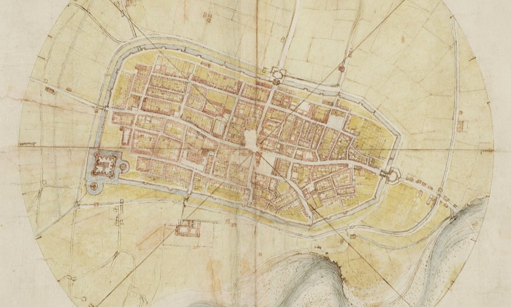
Leonardo da Vinci is justly famous for a lot of different things, but we’ve heard somewhat less about his mapmaking prowess than his painting or mechanical designs. His 1502 map of the Italian town of Imola is the oldest surviving example of an ichnographic (i.e. bird’s-eye-view) map of a place, a type of map that is ubiquitous today in the form of satellite imagery.
Most Renaissance maps are known for their fanciful inclusion of dragons, castles, and undulating mountainsides, and most of them show buildings in elevation, or the “oblique perspective.” But da Vinci’s sought to capture the proportions and relationships between land features more accurately, and he developed new technologies to do so. To make this map of Imola, he may have used the special hodometer and magnetic compass he’d already invented (he’d been fascinated by maps and optics for years). With careful measurements in hand, he drew every “street, plot of land, church, colonnade, gate and square, the whole encompassed by the moat,” writes the Renaissance historian Paul Strathern.
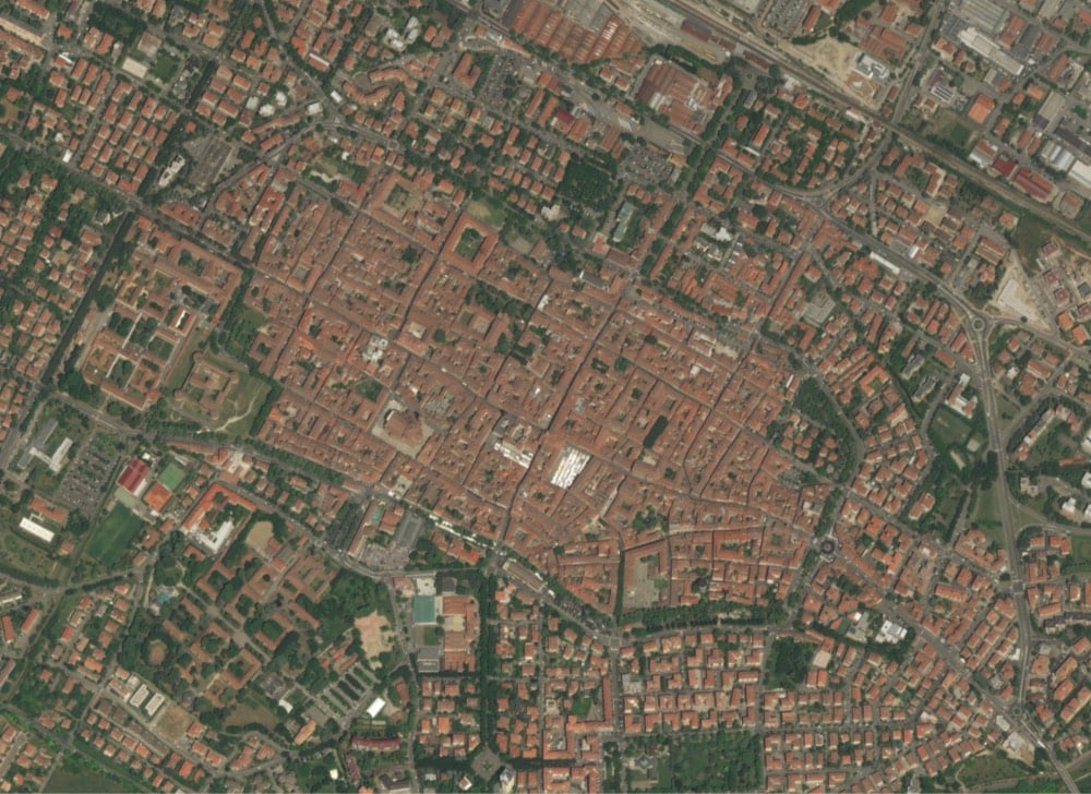
Here is Leonardo’s Imola map (cropped) compared with a contemporary satellite image:


As Edwards notes in the video, Leonardo’s map is not strictly an illustration or drawing of a place but more of an infographic. We take this type of map for granted now, but 500 years ago, that shift was a genuine innovation.


Stay Connected