Eclipse maps of the US, from 2000 BC to 100 years into the future
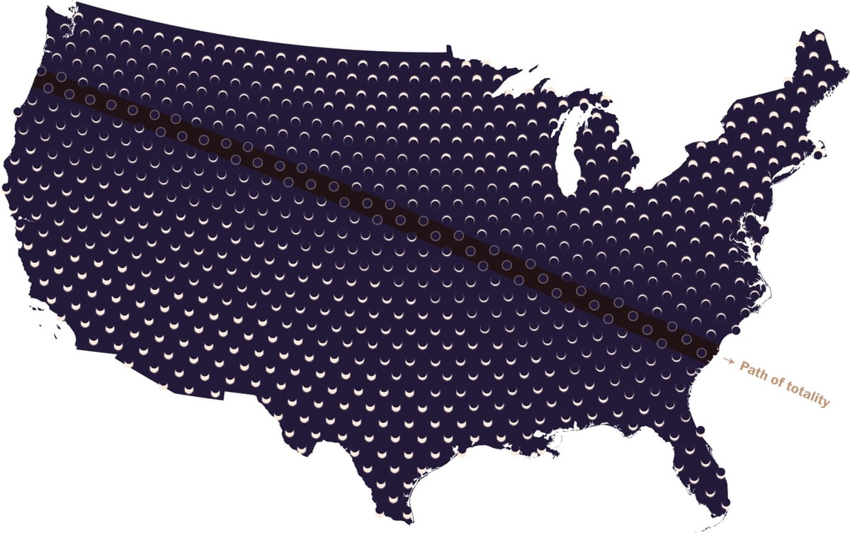
The Washington Post has a cool series of maps related to the total solar eclipse happening in August. The one above is a one-shot view of what the Sun will look like across the US on August 21 and there are other maps with captions like “The last eclipse over these areas occurred before Columbus’s arrival in 1492” and “Total solar eclipse paths over the continental U.S. since 2000 B.C.”
In the last 100 years, some areas have been in the paths of multiple eclipses: New England, for example, saw four. (During its World Series dry spell from 1918 to 2004, the greater Boston area alone saw two.)
Others weren’t so lucky. Just 200 miles away in New York, construction on the Empire State Building had not started yet the last time the city saw a total solar eclipse (1925). San Diego had a population of less than 100,000 the last time it was eclipsed (1923), and Chicago hasn’t seen a total eclipse at all in the last 100 years. An area near Tucson has the longest dry spell in the Lower 48: The last total solar eclipse it saw was in the year 797.
The U.S. mainland has averaged about seven total solar eclipses per century since 2000 B.C. Some areas have seen as many as 25 eclipses, while others, such as spots west of Minneapolis, have seen only four in the last four millennia.

Socials & More