NASA’s super accurate map of the 2017 eclipse
Using data about the Moon’s terrain from the Lunar Reconnaissance Orbiter as well as elevation data on Earth, NASA’s Ernie Wright created a very accurate map of where and when the August 2017 eclipse will occur in the United States.
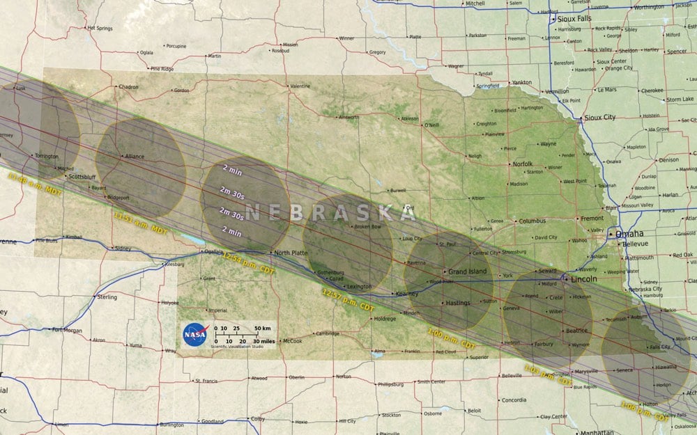
Standing at the edge of the moon’s shadow, or umbra, the difference between seeing a total eclipse and a partial eclipse comes down to elevation — mountains and valleys both on Earth and on the moon — which affect where the shadow lands. In this visualization, data from NASA’s Lunar Reconnaissance Orbiter account for the moon’s terrain that creates a jagged edge on its shadow. This data is then combined with elevation data on Earth as well as information on the sun angle to create the most accurate map of the eclipse path to date.
You can download maps of your area from NASA’s official eclipse website…I will be studying the Nebraska map closely.
See also Eclipse Megamovie 2017, an eclipse simulator you can use to check what the eclipse will look like in the sky in your area, and what looks like an amazing eclipse watching festival put on by Atlas Obscura.
Socials & More