First election map
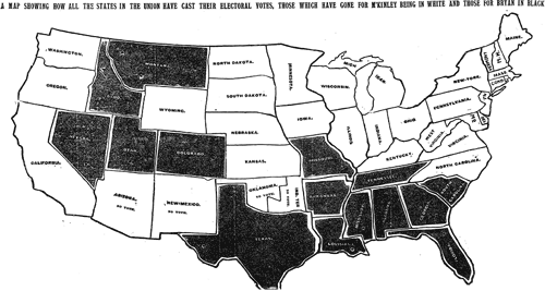
Matthew Ericson tracked down the first national election map published in the NY Times; it showed William McKinley’s victory over William Jennings Bryan.

The speed with which the results made it into print boggles the mind given the technology of the day (especially considering that in the last few elections in the 2000s, with all of the technology available to us, there have been a number of states that we haven’t been able to call in the Wednesday paper).
(thx, tyson)


Stay Connected