Advertise here with Carbon Ads

This site is made possible by member support. ๐Ÿ’ž

Big thanks to Arcustech for hosting the site and offering amazing tech support.

When you buy through links on kottke.org, I may earn an affiliate commission. Thanks for supporting the site!

kottke.org. home of fine hypertext products since 1998.

๐Ÿ”  ๐Ÿ’€  ๐Ÿ“ธ  ๐Ÿ˜ญ  ๐Ÿ•ณ๏ธ  ๐Ÿค   ๐ŸŽฌ  ๐Ÿฅ”

New Google Maps features

Not sure when these features were added, but Google Maps now displays public transportation stops (NYC subway, the T in Boston, the L in Chicago) and building outlines for metropolitan areas. Here’s a shot of the West Village in NYC:
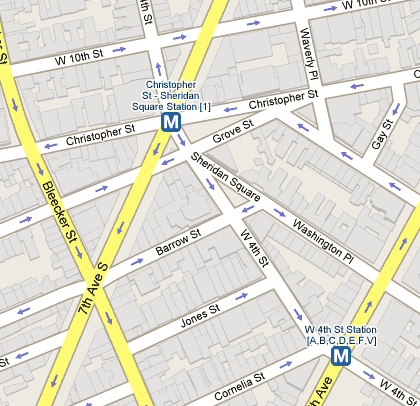
Google Maps subway stops and buildings

Tiny but useful improvements. (thx, meg)