An 11-foot long ribbon map of the Mississippi River from 1866
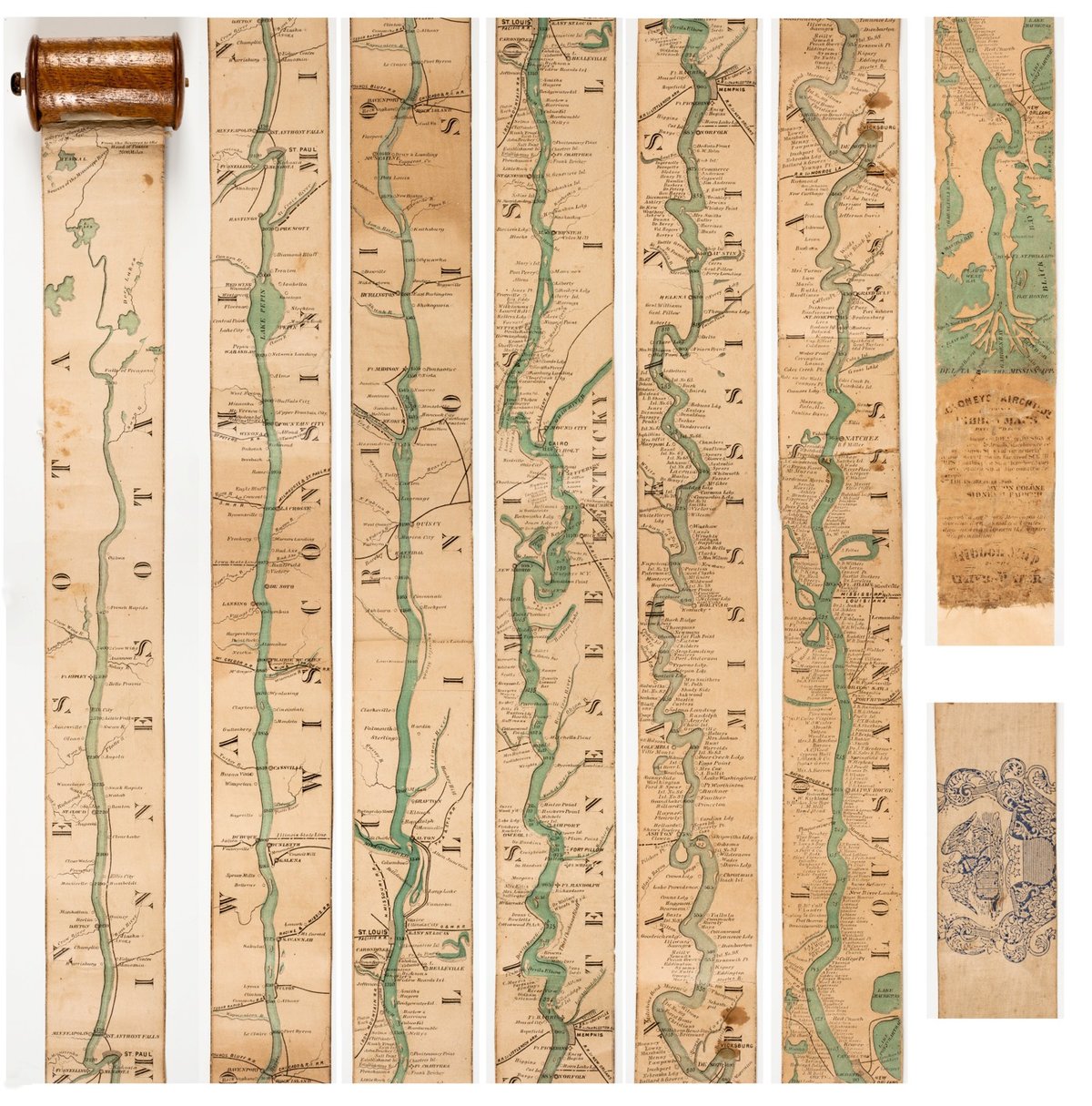
The Mississippi River runs for more than 2300 miles straight through the heartland of America, more or less straight from north to south. Representing the river in any detail presented a challenge for mapmakers wishing to provide maps to those wanting to travel along the river. In 1866, Coloney & Fairchild solved the problem by producing the Ribbon Map of the Father of Waters, a 2-inch wide & 11-foot long map that spooled up into a carrying case via a hand crank. From Nenette Luarca-Shoaf’s description of the map:
Coloney and Fairchild’s patented apparatus required that the single sheet be cut into strips, attached end-to-end, mounted on linen, and then rolled inside a wooden, metal, or paper spool (fig. 4). The resulting portability of the map was crucial because, as advertisements indicated, it was intended for business travelers, steamboat navigators, and tourists.
You can explore larger images of the ribbon map at the David Rumsey Map Collection or the American Antiquarian Society.
See also the meander maps of the Mississippi River. And I would love to see a satellite photo trip down the Mississippi like Best of Luck With the Wall, Josh Begley’s video journey along the 2000 miles of the US/Mexico border. (via open culture)
Update: In the 1840s, John Banvard painted a “moving panorama” of the Mississippi that measured 1300 feet in length. (via @mattbucher)
Socials & More