Mapping photos of old NYC
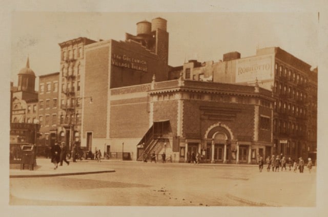
OldNYC offers a map view of old photos of New York City, drawn from the collection at the New York Public Library. This is fantastic, like a historical Google Street View. For instance, there used to be a huge theater on the corner of 7th Avenue and Christopher St, circa 1929:

If I didn’t have a thing to do this afternoon, I would spend all day exploring this. So so good. (via @mccanner)


Stay Connected