Advertise here with Carbon Ads

This site is made possible by member support. ๐Ÿ’ž

Big thanks to Arcustech for hosting the site and offering amazing tech support.

When you buy through links on kottke.org, I may earn an affiliate commission. Thanks for supporting the site!

kottke.org. home of fine hypertext products since 1998.

๐Ÿ”  ๐Ÿ’€  ๐Ÿ“ธ  ๐Ÿ˜ญ  ๐Ÿ•ณ๏ธ  ๐Ÿค   ๐ŸŽฌ  ๐Ÿฅ”

County-by-county voting maps for the past 112 years

The Blaze has a collection of county-by-county election maps for every US Presidential election since 1900.
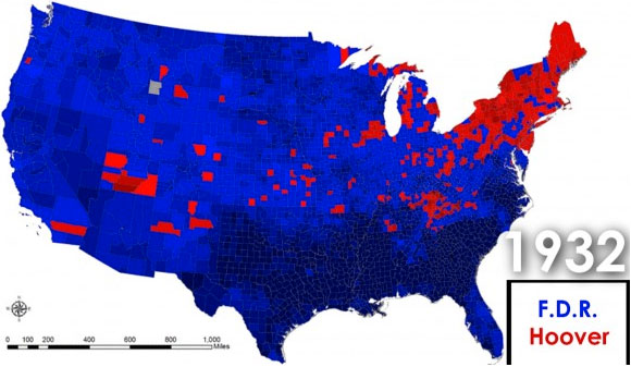
1932 Election Map

The video at the bottom is worth watching to witness the shift between a north/south divided country to a urban/rural divided country over the past 20 years.